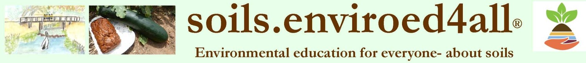
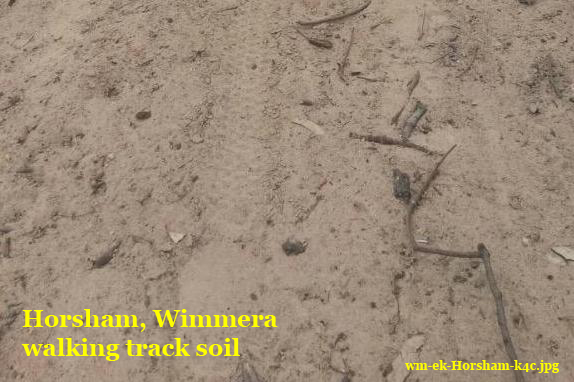
Soil as a recreational base for a walking track along the Wimmera River at Horsham
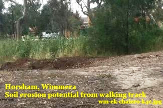
 Description – grey, sandy
Location – on flat river verge, adjacent to Wimmera River within the Rural City of Horsham
Community values/uses for this soil
Fitness from the path along the River for walking
Pleasure in being in the River bank environment.
 Challenge for soil beside a river for this recreational use –
Potential for erosion from bare soils, especially in times of high flow or flood
Management for soil as a walking track in a ‘bush’ area – replenished periodically
See more about
-the Horsham Rural City Council’s Walking Trails pdf or this Victoria Walk’s webpage
– soil functions along the Wimmera River in these Jeparit Banks, Verge and Lake Soil Selfies and in LN Post
– soils supporting walking places in Soil Selfies from Pine Plains in the Mallee, Perry sandhills and Innaminka in the Outback, the Styx Forest in Tasmania, and Weissenstein Forest in the Swiss Jura and an urban park Potsdam in Germany.
Credits- EK, of Horsham, gives permission for her photos and information to be used under a (cc) license 2015
Editing and page created by Jeanie Clark, enviroed4all®, Warracknabeal, for use in education under a (cc) licence 2015
Return to more Wimmera-Mallee Soil Selfies or other locations
page published 8 August 2015, updated 10 January 2016