Sand dune landform in Wyperfeld National Park
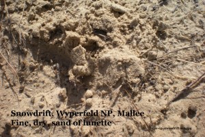
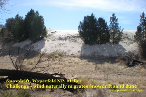
 Description: fine dry white sandy topsoil of a lunette (crescent shaped sand dune)
Location: eastern side of Pine Plains (an old lake bed),
sand dune overlaying flat ground at ‘Snowdrift’ campground
in Wyperfeld National Park, near Patchewollock in the Mallee, Northwest Victoria
Values for this dune soil:
– Tourism -Its unusual soil colour and texture is an attraction for visitors to this beautiful park
– Foundation – on which to pitch tents, park caravans, walk
– Recreation – great fun for children to play on the dune as a natural playground, hike, photograph etc
– Native vegetation – home to local plants, including these found in September 2017:
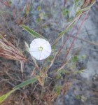
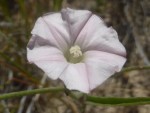 Australian Bindweed (Convolvulus angustissimus subsp. fililobus),
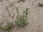
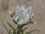 Poached Egg Daisy (Polycalymma stuartii) – not yet opened to show is yellow centre
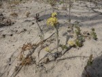
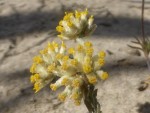 Sand Sunray (Rhodanthe tietkensii)
 Challenges and management for this moving sandy soil:
– – Wind– blows the sand around, especially in years of low rainfall,
– which over time is slowly causing the sand dune to naturally drift eastwards and take over trees.
– Management– no 4WD is allowed on the dune
See more about
– this area in the “Mallee Drive” pdf description
– more drifting sand Soil Selfies at Perry Sandhills in New South Wales and Copeville in South Australia and in LN post
– more sandy soils which can be affected by 4WD in Soil Selfies for the dry bed of Lake Hindmarsh, Victoria
Credits : Emily Parnaby, from Parks Victoria, Speed, gives permission for their photos and information to be used under a (cc) license 2015. Plant photos by Jeanie Clark, with identifications by Jocelyn Lindner. Editing and page created by Jeanie Clark, enviroed4all®, Warracknabeal, for use in education under a (cc) licence 2015
Return to Soil Selfies Collection by places from Wimmera-Mallee
page published 25 July 2015, with Spring flowers update 6 Nov 2018

Pingback: 2 new Soil Selfies | soils.enviroed4all.com.au