Soil forms a river’s channel – shape and its banks, eg Wimmera River, at Jeparit
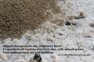
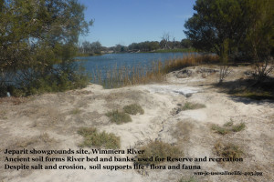
 Description: sand over clay underground salty aquifer
and surface has salted patches 
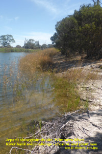
Location: river bed. steep banks and verge on a long stretch
between two cut-off meanders
Values :
– Foundation for the Wimmera River, giving it its depth, width, shape and straight and ox-bows stretches
 – River Reserve protecting remnant river habitat with
* ground covers (eg Ruby Saltbush),
*bushes (eg Melaleucas) and
* River Red Gum trees,
*and associated fauna especially birds, especially waterbirds, like Pelicans, and the insect and other life they depend upon.
– Community access to river for recreation along and in the River
– School education – as an easily accessible and nearby site
Challenges of the soil underlying this Reserve, managed to protect the environment:
1 Salinity
– From underground aquifer leaching into the River when at low levels, and evaporating salt on the banks
– Also at low levels, passed down along the River’s length to this almost end of the River
– From surface water, running off to the River from the adjacent land and evaporating en route into salt scalds
– Salty soils is also revealed in die-back of trees and the appearance of salt tolerant species
2 Instability of banks
See more
– about the Wimmera River at the height of its salinity problems in 2009 near the end of the decade of drought.
– about the alluvial soil salinity problems and their management of the Lower Murray River flooplain in the Long Flat Soil Selfies from South Australia
-about alluvial soil problems and their management on the Upper Danube River floodplain in this Slovakian Soil Selfies
– about soils supporting landforms in which water can collect in LN post
Credits: Photos and page created by Jeanie Clark, enviroed4all®, Warracknabeal, for use in education under a (cc) licence 2015
Return to more Wimmera-Mallee Soil Selfies or other locations
page published 9 August 2015, updated 9 January 2016
